Map reading and map interpretation questions | form three Geography
Find Map reading and map interpretation examination questions, form three Geography in acaproso.com
| # | Question |
|---|---|
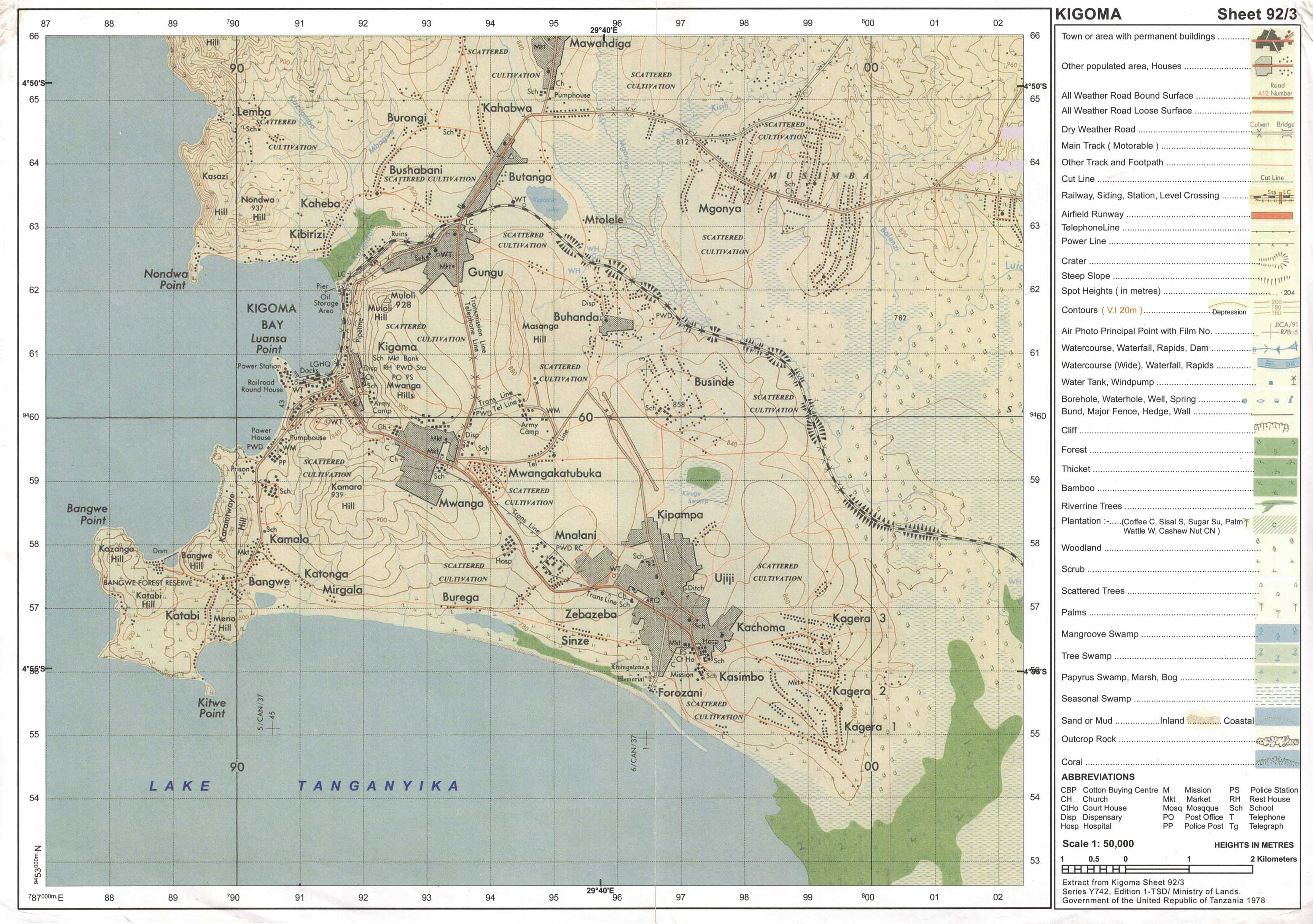
| 1 | Study the map extract of Kigoma sheet 92/3 and answer the following questions.
Practical |
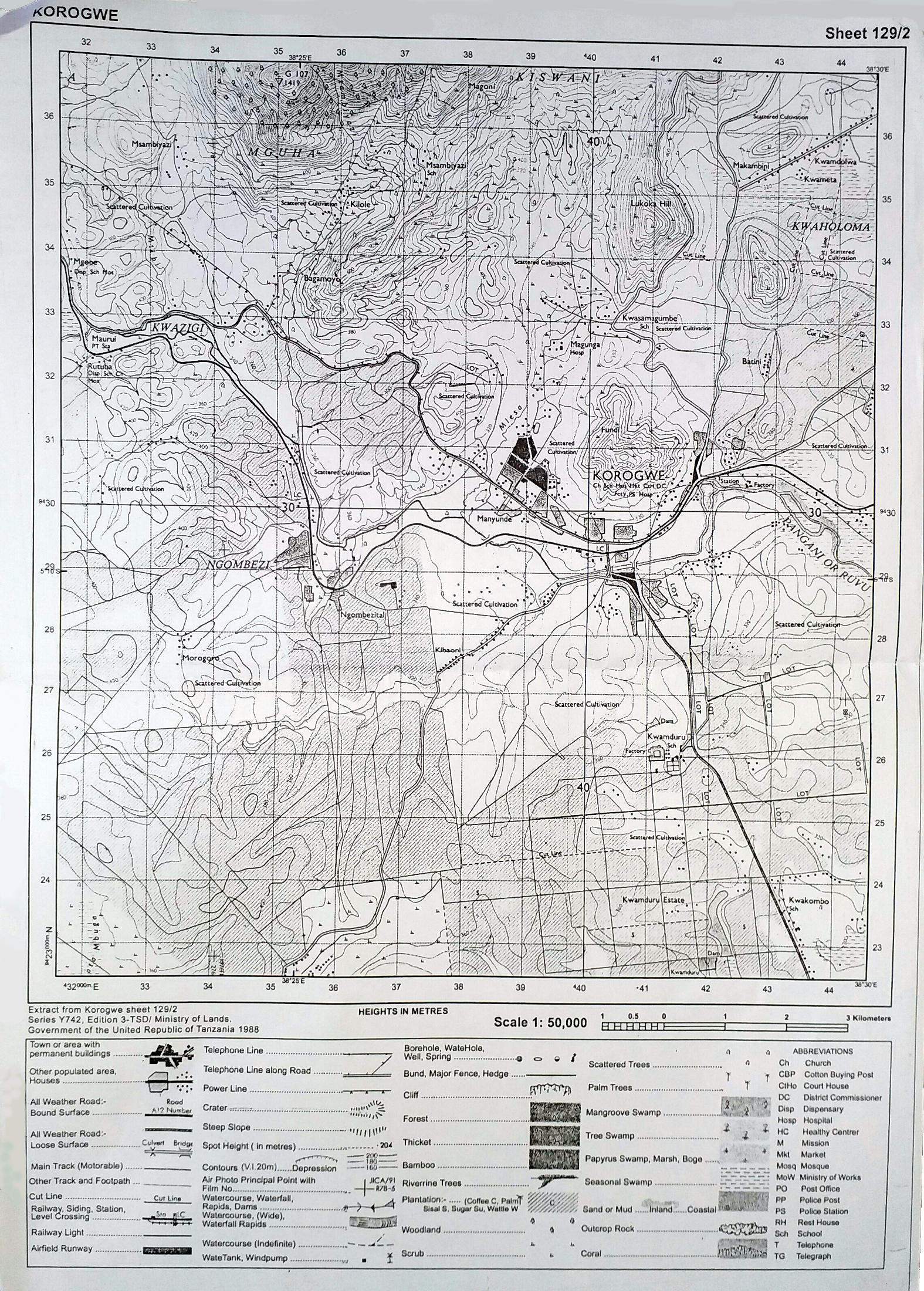
| 2 | Study the map extract of Korogwe sheet 129/2 and answer the following questions:
Practical |
| 3 | Carefully study the map extract of Galula provided then answer the following questions.
Practical |
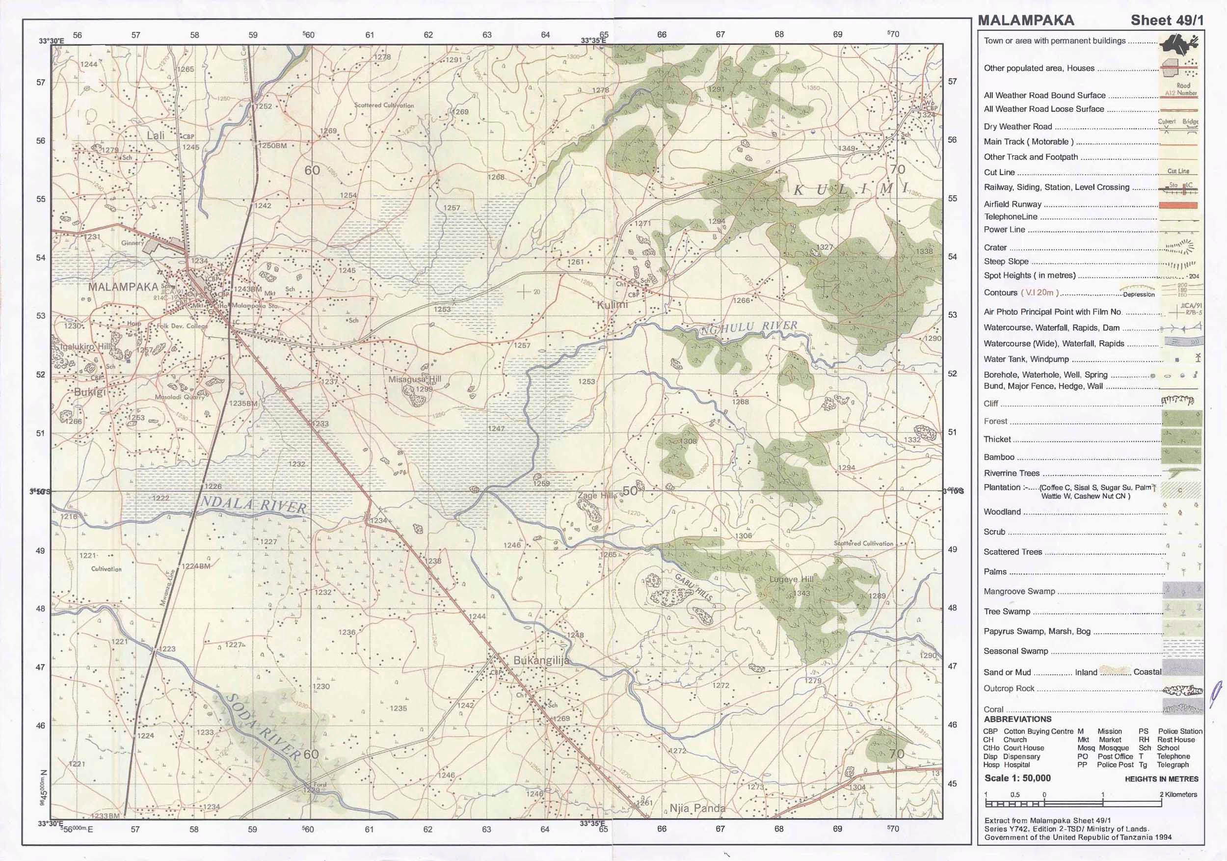
| 4 | Carefully study the map extract of Malampaka (sheet 49/1) provided and answer the following questions:
Practical |
| 5 | Study the printed map extract of Korogwe (Series Y742 sheet 129/2), then answer the following questions:
Practical |
| 6 | Study the printed map extract of Kigoma (Series Y742 sheet 92/3), then answer the following questions:
Practical |
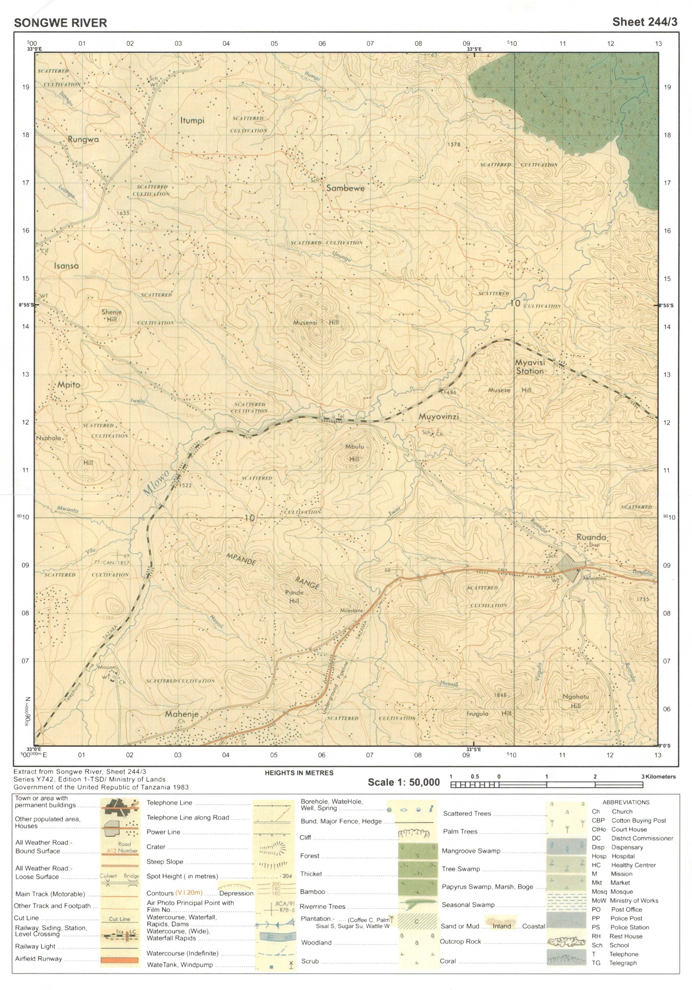
| 7 | Study the printed map extract of Songwe River (sheet 244/3), then answer the following questions:
Practical |
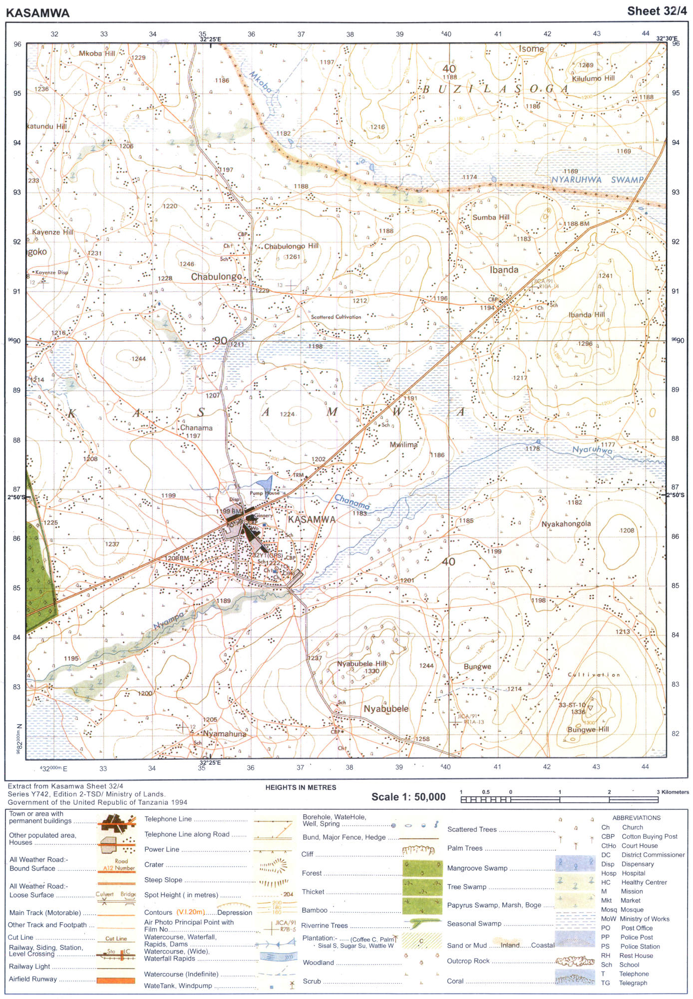
| 8 | Study the map extract of Kasamwa (sheet 32/4), then answer the questions that follow:
(a) Identify two ways that have been used to show relief on the map.
Practical |
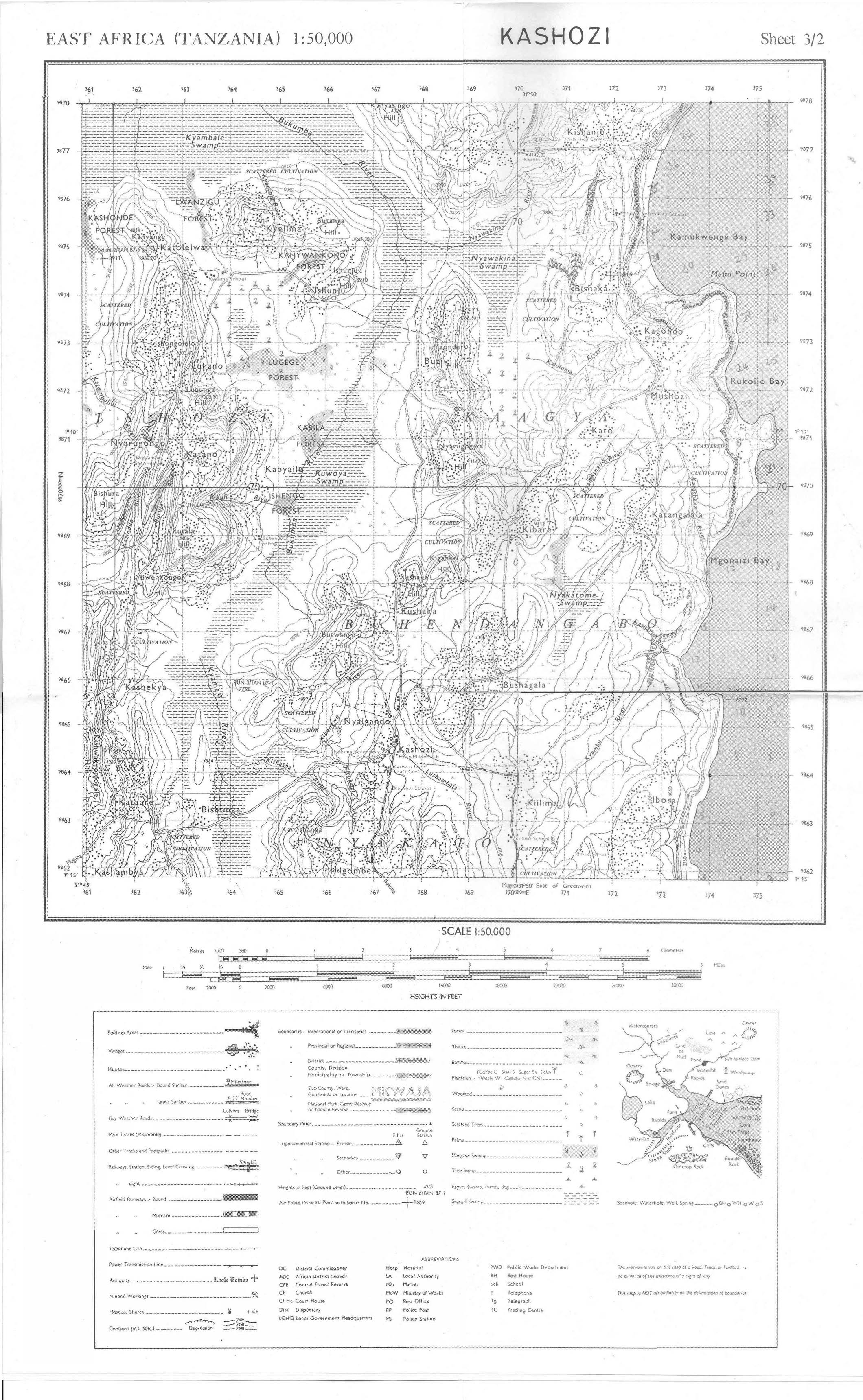
| 9 | Carefully study the map Extract of Kashozi sheet 3/2 provided then answer the following questions.
Practical |
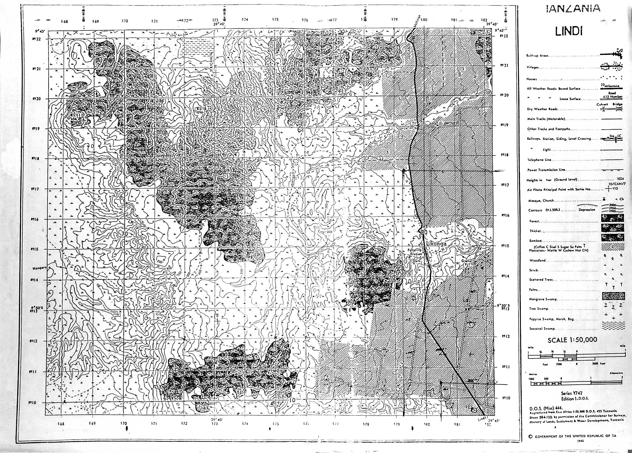
| 10 | Carefully study the map Extract of LINDI provided, and then answer the following questions.
(b) How long in Kilometers is the Lindi-Nachingwea allweather road (bound surface). (c) Giving two evidence from the map, name the type of climate experienced in this area. (d) How big in Km2 is the area covered by the forest south of grid line 160?
Practical |

 Acaproso Login